UPDATE, JUNE 2023: National Park Service contractors have removed the last pieces of the wreckage from the plane crash near Waterrock Knob. More info via nps.gov.
We’re a little tense here in South Carolina as Hurricane Ian turns in our direction. I have a new post in the works that I will hold onto for next week, but in the meantime I’m unlocking a subscriber-only post that originally ran on July 11. Be safe out there.
When I asked the park ranger at the trailhead for Waterrock Knob how to find the plane wreck, she sighed a little.
“I’ll tell you what I officially have to say,” she began, before explaining that it’s off the trail and unmarked, that it’s not safe, and that she couldn’t tell me how to get there.
The ranger had been talking to a young boy, maybe 10 or so, who was telling stories about hiking and camping with his “pa” in the mountains, and I’d interrupted their conversation to ask my question. At this point the boy turned to me and said, “Oh, I can tell you how to get there.”
He said I should look for a left branch off the trail shortly before I arrived at the knob. From there, amateur trail enthusiasts had marked the path to the airplane wreckage with a series of blue, yellow, and occasionally orange spray-paint marks. He assured me it wasn’t that hard, that he’d made the hike once in the dead of winter. I thanked him, thanked the ranger, and headed for the trail.
My wife and I were staying in Asheville, N.C., for a weekend without our kids, and she’d been reading about this site for weeks. According to some travel and hiking blogs, a Cessna plane had crashed in 1983 on a mountain between Waynesville and Sylva, leaving the pilot and the single passenger dead. The terrain was impassible for heavy equipment, so rescue and cleanup crews had only managed to remove the engines and the bodies from the crash site. The rest of the plane, including a mostly intact fuselage and wings, had been left on the mountainside for nearly 40 years.
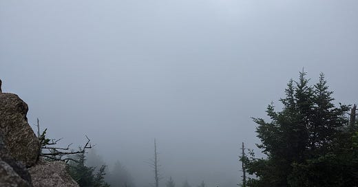
Starting at the Waterrock Knob visitor center, at milepost 451.2 on the Blue Ridge Parkway, we took the easygoing half-mile hike to Waterrock Knob, a scenic overlook a mile above sea level. The marked path took us to the 16th-highest peak in the Eastern U.S., with a stunning vista of the surrounding mountains and valleys at times fully obscured by a whooshing thick cover of clouds.
But almost everyone we passed on the trail was talking about the plane crash. They’d seen it thanks to travel influencers on TikTok and Instagram, and they wanted to find it themselves.
Turning back from the knob, we found the branch my young friend had mentioned and followed it into the woods. The path was well-defined at first, then it started forking and passing through some overgrown brush. Sure enough, someone had sporadically marked tree trunks with blue and yellow and occasionally orange paint, in no apparent pattern. I have no idea who maintains this path, but it seems to be an ad hoc operation.
After stumbling down some steep inclines and over some mossy roots, we heard voices chattering up ahead and knew we were close. We saw the small crowd before we saw the wreckage.
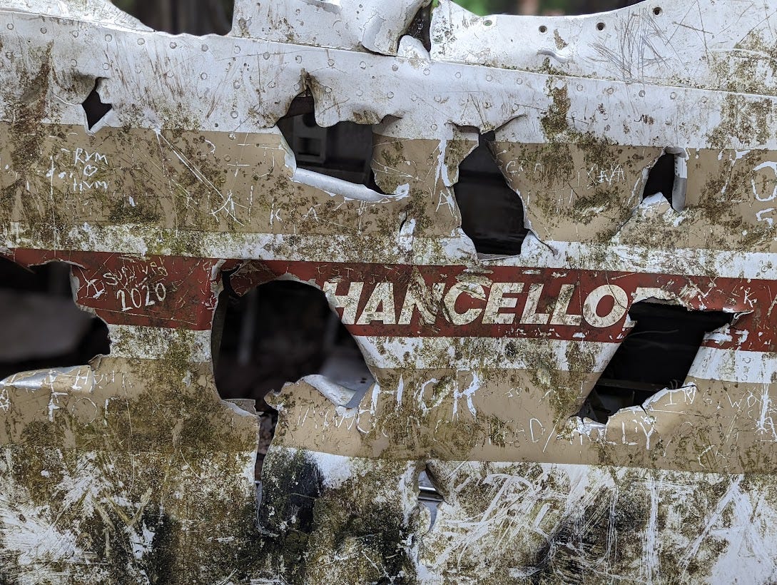
The site is remarkably well preserved. Despite some obvious vandalism, no one seems to have tried carrying off any major souvenirs. I watched nervously as a family’s young kids slipped and stumbled and horsed around inside the remains of the cockpit, near broken glass and rusty edges. My anxious dad senses were tingling.
The fuselage sits at the top of a steep drop-off. I padded down the loamy slope maybe 100 yards and saw debris that looked like it hadn’t moved in decades: mechanical parts, wires, rubber seals, most of a wing, even some scraps of vinyl upholstery and carpet. This stuff won’t biodegrade. Some parts were still wrapped around trees. Ferns and roots and leaf litter obscured the jagged remains.
We stood in silent judgment of people taking group photos beside the plane wreck, but we were really no different. We were looky-loos gawking at a place where two people died. We were following the same perverse instinct as everyone else who strayed from the trail map that day. Someone had scratched the graffito “I SURVIVED 2020” into the paint on the fuselage, and I thought for a minute about how we visit dead places to celebrate survival.
I’m not sure how long people have been hiking to this site. Judging by pictures posted online just three years ago, it seems like there’s been a recent uptick in vandalism. Someone punched holes in the side; lots of people scribbled inane messages on the metal about their bachelor weekends; a few left cellophane wrappers from the snacks they brought.
It was quite a sight, there’s no denying that. To walk through the woods and find a largely intact heap of twisted metal from 4 decades ago—that’s worth the drive and the walk. I wasn’t sure how to solemnize the occasion, in part because I didn’t know much about the specifics of the crash. The travel blogs tend to leave out the cause of the crash and the names of the people who died.

The crash happened on Thanksgiving Day, Nov. 24, 1983. The pilot was Ernest Martin, 53, of Rolling Meadows, Illinois, a northwest Chicago suburb. The twin-engine Cessna 414 had 8 seats, but the only passenger was Kreszentia “Centa” Eggar Jarrett (also spelled Jarrette in some news reports), 42, also of Rolling Meadows.
The Asheville Citizen wrote that the two had flown out of the DuPage County (Illinois) Airport and that Jarrett was flying to visit her two daughters who were enrolled at Western Carolina University. The Chicago Tribune wrote that Martin, a German immigrant, was the owner of Martin Tool Works Inc., a machine tool company he’d founded 26 years ago and grown to a size of 70 employees. Jarrett was his secretary. Reporter James Kane wrote:
Martin, a pilot for 25 years, regularly flew around the country on business, said Tim Sullivan, a company official. Martin was taking Jarrett to North Carolina to visit several of her children who live with her ex-husband, Floyd Jarrett, of Bryson City, N.C. Martin also had friends in the area and had flown before to the Jackson County airport, eight miles from the crash site, Sullivan said.
They hit stormy weather on the way over the Blue Ridge. A Civil Air Patrol spokesman told the Citizen that Martin had failed to file a flight plan despite the poor visibility conditions in his flight path. Aviation regulations at the time required pilots to file a flight plan if they planned to “fly on instruments” in bad weather.
The plane was missing until a pilot named Harry D. Maynard from Cashiers was passing over the mountain on a pleasure flight and spotted what looked like a wreck. Five days after the plane’s disappearance, a rescue squad from Haywood County hiked in.
The Citizen reported:
“Although there is a primitive trail halfway to the crash site, rescuers had to blaze their own trails in and out. Ice-covered rocks and a light dusting of snow made footing treacherous. Gusting winds added to the chill.”
After an hour, the team found the frozen bodies of both victims, who appeared to have died instantly. Martin’s body was 150 feet uphill from the plane; Jarett’s was near the wreck.

I wonder if the trail we followed on our vacation hike was the same one the rescue crew hacked through the forest in 1983, the same one they retraced as they carried the bodies back to an ambulance on the Parkway. I can’t say for sure.
One way of processing a tragedy is to tell ourselves we would have survived it through our strength or wits or better decisions. I try to avoid that way of thinking. What do I know about, say, flying a twin-engine plane across the Blue Ridge or camping in the Dyatlov Pass?
The final report on the crash from the National Transportation Safety Board (PDF here) noted that Martin had flown at night into “known adverse weather,” including clouds and rain, and that his altitude was “inadequate” after “several up & down excursions.” A toxicology report found he had a blood alcohol content of .04%.
I still have to think about what draws us to grim sites like this one. Why are we disaster tourists? Are we pausing adequately to consider the fact of death? My own motivations are muddled.
***
Brutal South is a free weekly newsletter about class struggle, education, and brutalist architecture in the American South (among other things). If you would like to support my work and get access to the complete archive of subscriber-only content, paid subscriptions are $5 a month.
Twitter // Bandcamp // Apple Podcasts // Spotify Podcasts // Bookshop


Nice research....I first went to this crash site about 10 years ago, there was not a real trail and it took me several hours of trekking to find the site..I actually went over a mile past the wreck on the Plott Balsams Trail. I found out about it via an insurance agent in Canton NC. The engines were recovered by a recovery agent via helicopter per the insurance company. Over the last few years the site has changed due to vandalism and folks taking items. The hike sort of became a highly visited trek for visitors and teenagers. There were even a couple companies who charge a fee to lead people there. One is "NC Tripping Travel Inc". Overall an eerie place and the plane was removed June 27th, 2023. https://wlos.com/news/local/wreckage-of-1983-cessna-plane-crash-removed-from-waterrock-knob